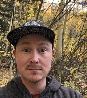
Jesse Nett earned his degree in Geography from UO and now he’s the Regional Cartographer for the USDA Forest Service in Colorado.
Jesse Nett graduated from the University of Oregon in 2010 with a degree in Geography, specializing in geographic techniques such as cartography, remote sensing and mobile data collection. Nett came to the UO after 10 years of working in another industry. He was ready for a change, and cartography at the UO was calling his name. Now, he’s the Regional Cartographer for the Rocky Mountain Region at the USDA Forest Service. After popping into a career fair in the EMU, Nett was hired at the USDA Forest Service, and he attributes his success in cartography thus far to the opportunities he had while at the UO.
“I think my tenure at the InfoGraphics lab was instrumental in me landing my position at the Forest Service,” Nett said. “There’s really only one cartography course that I took, with Jim Meacham, and through that class, I got to apply and learn new skills and software while I was working at the lab. That gave me the competitive advantage to get the position I have today.”
The InfoGraphics Lab is a cartography and geospatial technologies facility that’s housed in the department of geography. The lab has worked with the university, the local community, and the state of Oregon, and Nett said their work on the Atlas of Oregon was one of the reasons he had his eye on the geography department at UO. Both undergraduate and graduate students can work on lab projects that equip students with crucial cartographic experience needed to enter the competitive field of cartography.
The work Nett is doing right now at the Forest Service draws from skills he learned through his time at the lab. Nett recently worked on the Shoshone National Forest visitor map, where he handled the production, printing, and distribution, both digital and hard copies, for the visitor map program. Thanks to the experience he had with the software and the opportunity to do production cartography on the Atlas of Yellowstone in the InfoGraphics lab, Nett had the necessary skills to jump right into his cartographic work for the USDA Forest Service before he even graduated.
“I never realized that I could get a job doing mapping for my entire career. It’s not something you can take a career skills test for,” Nett said. “But I love the art and the science of the discipline. I learned the necessary skills working with the UO faculty, the lab, and actually doing production cartography there at the UO.
Nett is currently based in Colorado, and in addition to his position as Regional Cartographer, he’s also the Regional Geographic Names Advisor for the area. He works with the State Names Authority to rename culturally insensitive features. Through community outreach, working with the tribes, and working directly with the states and forests, Nett said they are able to improve the naming process at both the state and federal levels.
Nett said his involvement with the non-traditional student union, the North American Cartographic Information Society, and the Association of Geographers gave him distinctive resources to draw on at UO that helped him launch his career. For current and prospective cartographers at the UO, Nett suggests specializing. “Now, Geographic Information Services (GIS) is a common skillset. So specializing—finding those connections, expanding your skills, focusing on the programming, analysis, or the cartographic side—is really important,” he said. Simply knowing the GIS application will not make students as competitive as it did when the software was relatively new, Nett adds.
“The InfoGraphics Lab is a unique resource at the UO, and it’s what makes the geography department as competitive as it is,” Nett said. “I can’t speak highly enough of the program and the faculty. Everyone is dialed into the community and willing to help. It’s that cohort at the UO that’s always been strong, and I value those relationships. I’m a proud duck.”
By Victoria Sanchez, College of Arts and Sciences Communications
